Winter’s Lingering Chill: Milwaukee Braces for a Chilly, Snow-Dusted Sunday
A Frosty Welcome to March
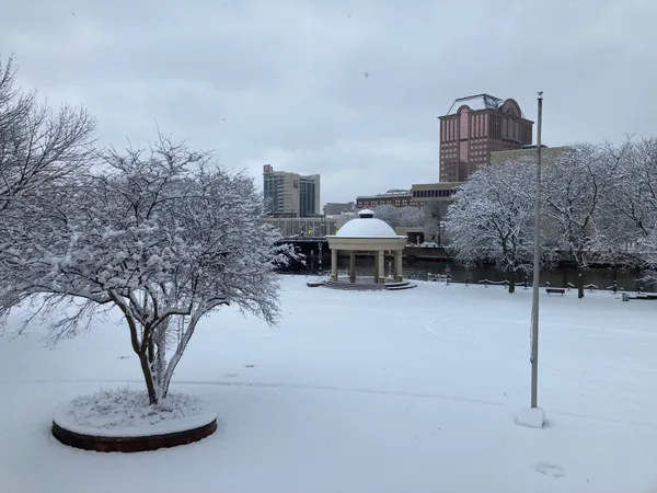
As the calendar turns to Sunday, March 1, 2026, Milwaukee residents are waking up to a reminder that winter isn’t ready to relinquish its grip quite yet. While many are looking forward to the eventual arrival of spring, today’s weather will feature classic Wisconsin late-winter conditions, characterized by biting wind chills, persistent cloud cover, and a dusting of lake-effect snow to start the morning.
Morning: Early Flurries and Chilly Commutes
The morning hours will be the most active part of the day for the Cream City. Early risers can expect temperatures hovering in the mid-teens to low 20s, but the real story is the wind chill. With a biting breeze coming off the lake, it will feel as cold as 10°F to 12°F through much of the early morning. Weather models indicate a specific window for lake-effect snow before 9:00 a.m. While these flurries are not expected to cause major disruptions, a light accumulation of under one inch is possible, particularly in neighborhoods closer to the shoreline. Visibility may be briefly reduced during heavier bursts of snow, so motorists are advised to exercise caution on bridge decks and overpasses.
Afternoon: Peak Temps and Overcast Skies
By the afternoon, the chance for precipitation drops significantly as the region settles into a mostly cloudy pattern. High temperatures are forecasted to reach between 27°F and 29°F, which remains well below the seasonal average. Winds will shift slightly, blowing from the northeast at approximately 5 to 9 mph, with occasional gusts reaching up to 15 mph. These gusts will maintain a steady chill throughout the day, making outdoor activities feel much colder than the thermometer suggests. The UV index remains at a low level (0), so there will be little relief from the sun despite occasional breaks in the cloud deck.
Evening: A Quiet and Cold Night Ahead
As the sun sets, the clouds will begin to thin slightly, though the air will remain quite cold. Evening temperatures are expected to bottom out in the lower 20s, with some inland areas potentially dipping to 20°F. Winds will continue to flow out of the east at about 7 mph. While no major rain or wind warnings are currently in effect for the Milwaukee area, the combination of high humidity (around 64% to 76%) and sub-freezing temperatures may lead to frost formation on parked vehicles. Looking ahead to Monday, a slight warming trend is anticipated, but for tonight, Milwaukeeans should plan to stay bundled up.
- Morning: 21°F - 23°F, 22% chance of lake-effect snow.
- Afternoon: High of 29°F, mostly cloudy, wind gusts to 15 mph.
- Evening: 24°F, overcast with gradual clearing late.

Public invited to review preliminary Red Arrow Park redesign alternatives at City Hall Rotunda open house

Wisconsin approves state historic marker for Milwaukee’s former This Is It! LGBTQ bar building
Milwaukee officials outline changes to Brady list process, raising questions about notice and oversight