Sunny Afternoon Skies Give Way to a Wintry Mix and Windy Evening
Morning: A Snowy Start Clearing to Bright Spells
Milwaukee residents woke up to a complex weather pattern this Thursday, February 19, 2026. The early morning hours saw a continuation of steady snowfall, with rates reaching between 0.5 and 1 inch per hour across southeastern Wisconsin. However, the National Weather Service indicated that this system began tapering off by 3:00 a.m., leaving behind some lingering flurries and dense fog. As the morning progresses, the fog is expected to lift, revealing predominantly sunny skies by late morning. Despite the cold start, the arrival of the sun will begin a significant warming trend for the region.
Afternoon: Unseasonable Warmth and Calm Breezes
By midday and through the early afternoon, Milwaukee will experience a pleasant break from the winter chill. Temperatures are forecast to climb significantly, reaching a daily high in the upper 40s, with some local estimates peaking at 48°F. This is notably warmer than the historical average high of 34°F for this date. During this window, winds will remain predominantly calm, averaging between 4 and 6 mph. It is the perfect time for residents to handle outdoor chores or enjoy a walk along the lakefront before the next weather system arrives from the west.
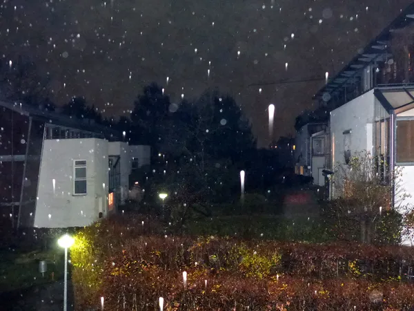
Evening: Rain and Wind to Dampen the Commute
The weather takes a dramatic turn as the sun sets. Starting around 6:00 p.m., clouds will thicken and a steady rain is expected to move into the Milwaukee area. Meteorologists anticipate over a quarter-inch of rainfall through the evening hours. Along with the precipitation, wind speeds will increase noticeably, shifting to 10-15 mph with gusts reaching up to 25 mph. Commuters should prepare for wet pavement and reduced visibility during the evening rush hour.
Overnight: Transition to Sleet and Freezing Rain
As temperatures begin to drop back toward the lower 30s tonight, the rain will undergo a transition. Around 2:00 a.m. Friday, the liquid rain is expected to briefly stop before changing over to a mix of sleet and eventually light snow. With a forecast low of 33°F, there is a significant concern for freezing rain and icy patches on the roads, particularly on bridges and overpasses. Several advisories remain in place:
- Winter Weather Advisory: Active for late-night transitions to ice and snow.
- Small Craft Advisory: In effect for Lake Michigan due to increasing wind gusts.
- Wind Warning: Expect gusts up to 25 mph as the storm system moves through.
Drivers are urged to exercise caution late tonight and into tomorrow morning as the wet roads from the evening's rain may flash-freeze, creating hazardous travel conditions for the Friday morning commute.