Southeast Wisconsin districts cancel Monday classes as snow, ice, and strong winds disrupt travel conditions
School closures spread across Southeast Wisconsin as storm impacts intensify
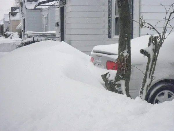
Multiple school districts across Southeast Wisconsin canceled in-person classes for Monday, March 16, as a late-winter storm brought a mix of freezing drizzle, sleet, and accumulating snow alongside strong winds capable of producing near-whiteout conditions in spots. Districts cited hazardous travel for buses, student drivers, and staff during the morning commute as the primary factor driving the decisions.
National Weather Service forecasts for the Milwaukee/Sullivan region indicated that slick conditions were developing quickly Sunday evening, with a transition from mixed precipitation to moderate to heavy snowfall expected overnight and into Monday morning. Forecasters also warned that strong gusts—capable of blowing and drifting snow—could sustain impacts even as snowfall rates diminish later Monday.
What the weather pattern means for Monday travel
Forecast discussions for the region described a sequence that often produces the most disruptive school-day conditions: an initial glaze from freezing drizzle or sleet, followed by heavier snow as temperatures and atmospheric profiles shift. That setup can leave untreated surfaces slippery before plows and salt crews fully catch up, particularly on neighborhood streets and secondary routes used by school buses.
Winds were expected to strengthen on the backside of the storm system, increasing the likelihood of blowing snow and rapidly changing visibility. Forecasters said near-blizzard conditions were possible in parts of southern Wisconsin, with the greatest impacts focused on overnight travel and the Monday morning commute window.
How districts handle cancellations and what families should expect
District responses varied by community, but most announcements centered on full-day closures and the cancellation of after-school activities and programs. Families were urged to monitor district communications for updates on athletics, extracurricular schedules, and any changes tied to building operations.
- Full-day closures were used to reduce exposure to early-morning road risk, especially for buses on rural and secondary roads.
- Activity cancellations were tied to both travel safety and uncertainty around the storm’s timing and wind-driven visibility.
- Districts emphasized that decisions can shift as conditions evolve overnight, particularly if ice develops before heavier snow arrives.
Forecasts for the Milwaukee-area region highlighted slippery surfaces developing rapidly, snow persisting into Monday morning, and the potential for significant commute impacts due to wind-driven blowing and drifting.
Broader regional context
The storm affecting Southeast Wisconsin was part of a larger multi-region system that brought heavy snow and high winds to portions of the Upper Midwest while severe weather threatened other parts of the country. In Wisconsin, the combination of mixed precipitation and strong winds created conditions that can deteriorate quickly, particularly overnight, driving school systems to favor closures rather than delayed starts.
Road conditions and visibility are expected to remain the key variables early Monday. Even after snowfall tapers, gusty winds can continue to reduce visibility and re-cover treated pavement, extending disruption beyond the end of the heaviest snow.