Double-Header Storm Threat: Milwaukee Faces Fog, Rain, and Severe Weather Risk
Morning Commute Hazards and Fog Advisories
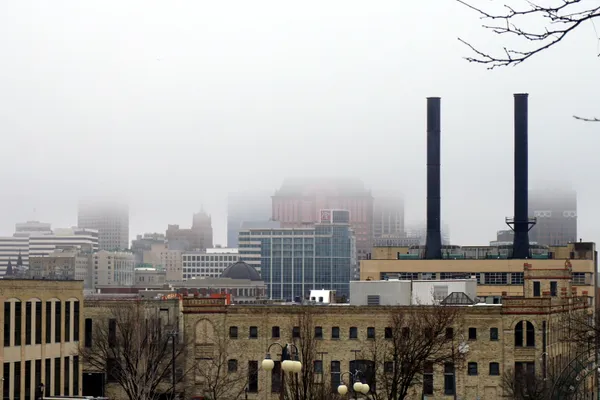
Milwaukee residents waking up this Friday, March 6, 2026, are greeted by a thick blanket of fog and a complex weather pattern. The National Weather Service has issued a Dense Fog Advisory for Milwaukee and surrounding southeastern Wisconsin counties, effective until 9:00 AM. Visibility in some areas has dropped to less than a quarter-mile, particularly along the Lake Michigan shoreline. Drivers are urged to use low-beam headlights and maintain extra following distance during the early morning hours.
Beyond the fog, patchy light drizzle and freezing drizzle have been reported across the region. While the freezing drizzle is expected to weaken as it encounters drier air, untreated surfaces and elevated bridges may remain slick through the mid-morning hours.
Afternoon Warmth and Initial Storm Rounds
As the fog clears, a significant warming trend will take hold. Temperatures are expected to climb rapidly, reaching an unseasonably warm high in the lower 60s. This surge in temperature is driven by strong southerly winds blowing at 10 to 15 mph, with gusts reaching up to 25 mph. However, the warmth comes with a price: the first of two planned rounds of rain is expected to arrive late in the morning.
By early afternoon, thunderstorms will likely develop. While the primary threat during the day is heavy rain and the potential for small hail, the atmosphere will remain unstable as a cold front approaches from the west. Rainfall totals for the day are forecasted between 0.5 and 2 inches, which may lead to standing water in low-lying areas and rising levels in local creeks and rivers.
Severe Threat Escalates into the Evening
The weather is expected to turn more volatile as evening approaches. A second, more potent round of storms is projected to roll across southern Wisconsin, with the highest risk for severe activity occurring after 9:00 PM. Forecasters have placed the Milwaukee area under a Marginal Risk (Level 1 of 5) for severe weather, noting that the following hazards are possible:
- Damaging Winds: Potential for gusts between 58 and 75 mph.
- Hail: Large hail between 1 and 2 inches in diameter.
- Tornadoes: While the risk is isolated, a few tornadoes cannot be ruled out as the front passes through.
- Heavy Rainfall: Repeated rounds of rain could result in localized totals up to 3 inches.
Safety and Looking Ahead
Residents should ensure they have multiple ways to receive weather alerts throughout the evening, especially as the most severe storms may arrive overnight. Temperatures will remain elevated in the upper 50s and lower 60s through the night before a sharp cold front arrives on Saturday, bringing a return to typical March chill. For today, keep the umbrella handy and stay weather-aware as this active spring-like system moves through the Cream City.

Milwaukee Public Schools proposes eliminating about 260 non-classroom jobs to address a $46 million deficit
Prosecutors charge Milwaukee man after Aurora Sinai Medical Center lobby shooting left two people wounded
Milwaukee Police Pursuit Policy Faces Renewed Scrutiny as Leaders Seek Limits on Reckless-Driving Chases